
Tunnel monitoring on the Romanian A1 Lugoj–Deva motorway
How the SURVIOT monitoring platform brought the geodetic and geotechnical measurements together on one interface during the excavation of Romania's largest road tunnel, for the contractor UMB.
Summary
Romania's largest road tunnel is being built on the Lugoj–Deva section of the A1 motorway. For the contractor UMB, as a partner of the Hungarian general contractor TunnelTech Kft., the SURVIOT monitoring platform collected and displayed the geodetic and geotechnical measurements on a single interface, from the start of excavation to the final breakthrough. According to its settings, the system also sent alerts and reports to the construction team.
The measurements confirmed that the tunnel support was adequate, the deformations remained small, and installing the instruments did not hold up the tunnel drive.
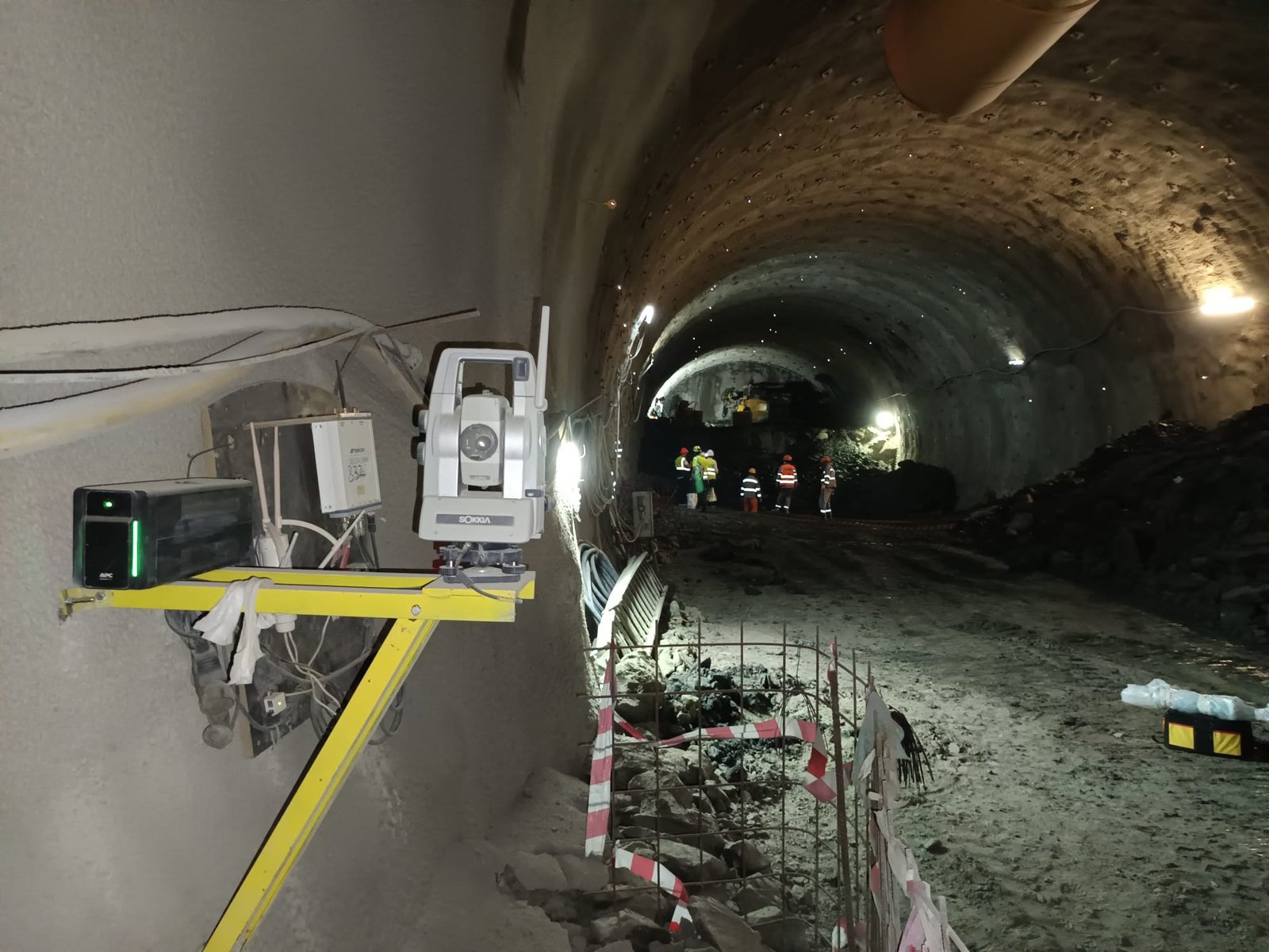
Automatic total station on the wall of the large tunnel, looking towards the excavation face.
The project in brief
| Location | A1 motorway, Lugoj–Deva, Margina–Holdea section (9.13 km), Romania |
|---|---|
| Tunnels | Two twin-tube tunnels: the tubes of the small tunnel are 367.5 m and 415 m long, those of the large tunnel 1,985 m and 1,825 m, more than 4.5 km in total |
| Construction method | NATM (New Austrian Tunneling Method), cut and cover where the overburden is shallow |
| Contractor | Romanian–Bosnian construction consortium of UMB and Euroasphalt |
| Project value | RON 1.82 billion excluding VAT, financed from the EU recovery fund (PNRR) |
| Monitoring period | Spring 2025 to autumn 2026, preparation in 2024 |
| Measured quantities | Convergence (automatic total stations and prisms), inclinometer, extensometer, NATM pressure cells |
| Role of SURVIOT | Data acquisition, processing, 3D visualisation, alerts, reports, construction log |
Bear tunnels, a large cross-section, several faces
The Margina–Holdea section is the last missing link in the more than 300 km motorway between Sibiu and the Nădlac border crossing. The tunnels are built under forested terrain with considerable differences in elevation. The press calls them the "bear tunnels" because of the bears' habitat. The cross-section of the large tunnel is exceptionally big, the region is seismically active, and work went on at several faces at once, around the clock.
NATM relies on measurements: the support is adjusted to the rock on the basis of continuously measured deformations. The contractor therefore needed a system that
- shows the geodetic and the geotechnical measurements in one place, for all the tunnel tubes,
- alerts immediately when a displacement exceeds its limit,
- also delivers a monthly report for each tunnel,
- can be operated by the site engineers themselves, without separate software and manual Excel processing.
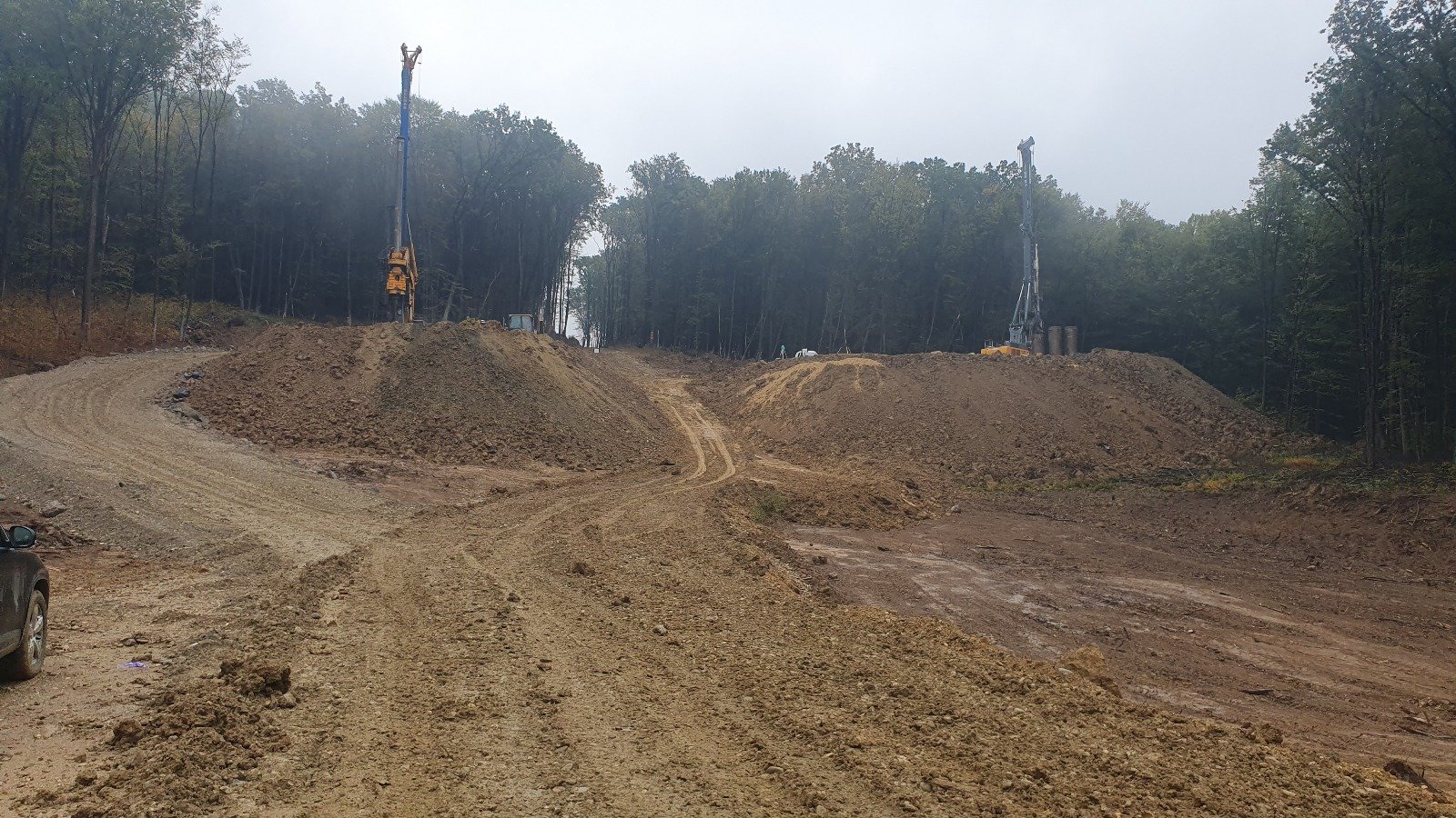
Piling at the portal on the forested hillside.
One platform for every measurement
SURVIOT brought the geodetic, geotechnical and construction data together on one platform, which ran on the contractor's own server (on-premise). The system also used the 3D model of the tunnels, so every measurement appeared in the right place with the right chainage. SURVIOT provided a full conversion between chainage values and 3D coordinates.
The general contractor on the Hungarian side was TunnelTech Kft., which also supplied the geotechnical expertise and the instruments. SURVIOT provided the monitoring platform and the data integration as its partner.
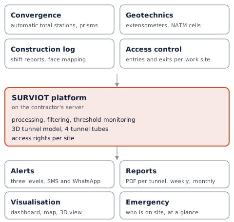
Structure of the monitoring system: 4 data sources, 1 platform, 4 outputs.
Four data sources, one interface
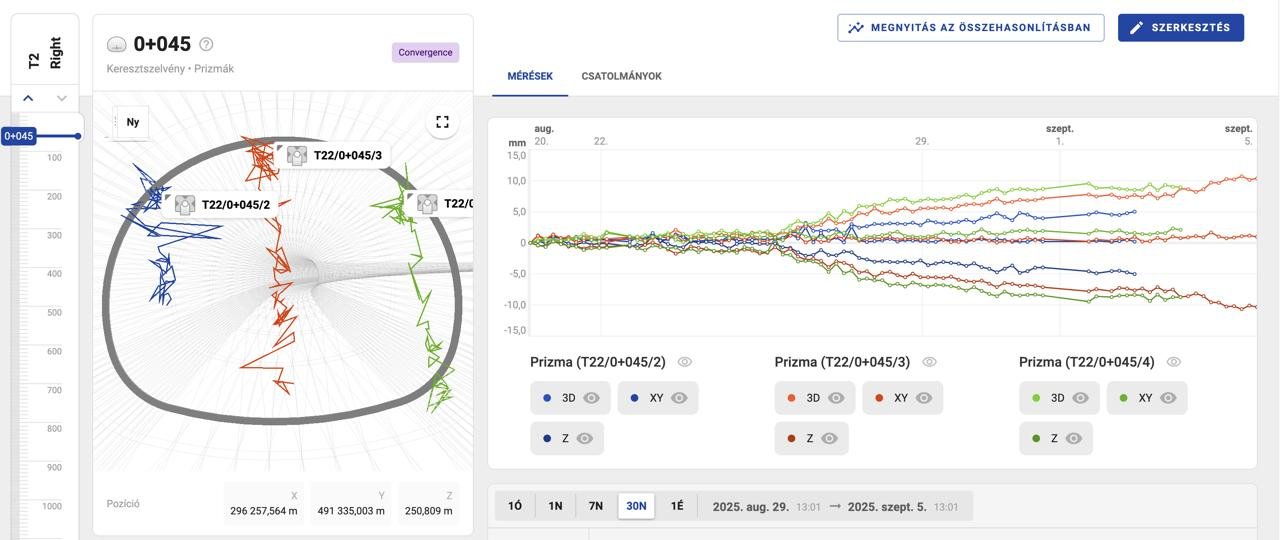
- Convergence. Automatic total stations measure the prisms placed in the cross-sections, and the data reach the platform without any human intervention.
- Geotechnics. The multi-point extensometers and NATM pressure cells of the instrumented sections built into the tunnel send data every half hour. The geologist on site brings in the inclinometer measurements with a single file upload, and the system draws the A and B direction, absolute and cumulative displacement from it, with a rotatable 3D view.
- Construction log. Shift supervisors record the work processes, headcount, machinery and face mapping reports tied to chainage, from both ends of the tunnel.
- Alerts and reports. Three-level limit values, notification by SMS and WhatsApp, and PDF reports per tunnel and for any period.
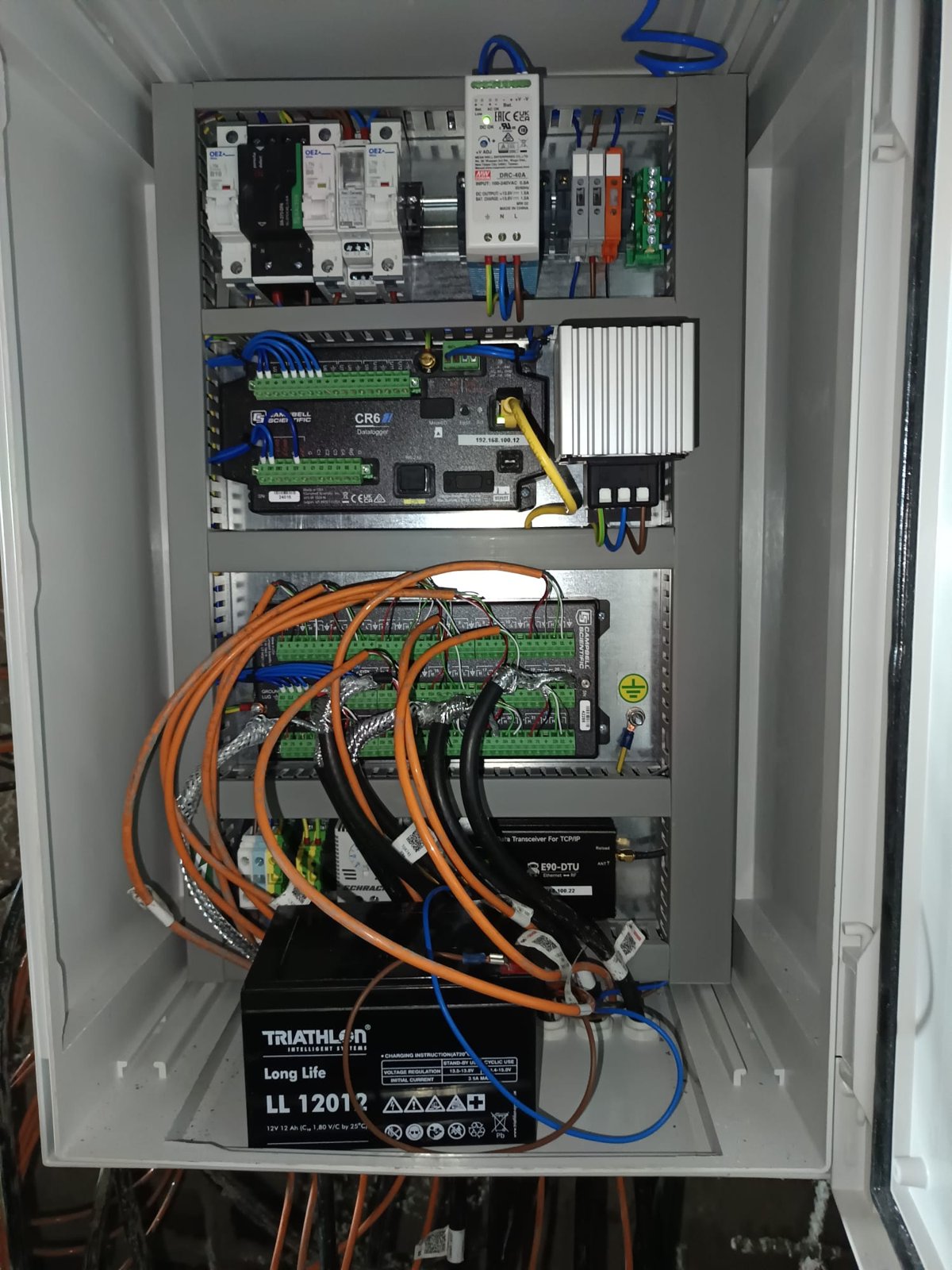
Data acquisition cabinet of a geotechnical instrumented section in the tunnel.
The system evolved along with the tunnel drive
Requests from the site team became live features along the way.
- Own IPI inclinometer module. The contractor would first have processed the inclinometer data in a separate software on an annual subscription. Instead, the import, the 2D and 3D visualisation and a full-screen chart for reports were built into the SURVIOT interface.
- A tunnel excavated from two directions. The construction log can be kept separately for each portal, so the progress of the two excavation faces can be followed even within a single tunnel.
- Rotatable 3D cross-section. The displacement vectors of the prisms can be seen per section, also rotated in space. According to the geotechnical expert, this visualisation gives additional information he had not seen before.
- Built-in quality control. The platform filters out measurements that show a jump orders of magnitude above the limit value, and flags when a prism ID and the measurement programme have slipped out of step. Coordinates arrive in the Romanian national projection system (Stereo 70), so an error from a wrong projection setting cannot enter the system.
- Access per tunnel. Permissions and reports can be set per site, and every party sees its own tunnel.
- Integrated access control. The access control system of the work sites was also brought into the platform, so it shows who is on each site at any moment. In an emergency this shows immediately whom to look for and where.
- Robust data path. The instruments kept measuring during network outages, the data were backfilled once the connection returned, and the geotechnical data stayed available for manual download.
Convergence section on the SURVIOT interface: displacement of the prisms in cross-section and over time (Hungarian user interface).
Up to the final breakthrough
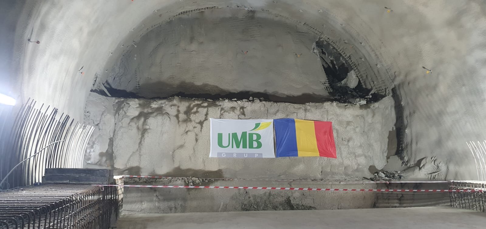
The final breakthrough took place in September 2026 and the excavation of the tunnels is complete. The monitoring covered the whole excavation period.
- Support confirmed. Despite the large cross-section, the measured deformations remained small, and the forecasts made a year earlier proved accurate. The measurements confirmed that the tunnel support and the construction were adequate.
- The breakthrough was visible too. The crown extensometer in the distant instrumented section also registered the effect of the breakthrough, so the effects of the excavation could be followed in real time.
- Reliable operation. The extensometers measured throughout the whole operating period, and so did most of the NATM cells. Data was lost only for a few days, when the power supply was cut during the invert concreting.
- Construction did not stop. While the instrumented sections were being installed, the top heading advanced and work continued at the rear face.
- One interface for everyone. The contractor's engineers, surveyors and geologists and the monitoring experts saw the same data, without separate software and manual compilation.
UMB is also counting on this monitoring solution for its next project.
Breakthrough in the UMB tunnel tube.
Sources
The project data come from the project documentation of SURVIOT and its partners. The public data on the motorway section (lengths, method, project value, breakthroughs) come from the following sources:
- Antena 3: First tunnel tube on the A1 Margina–Holdea section broken through (July 2025)
- Economica.net: The "bear tunnels" section will not be finished in 2026 (June 2026)
- Adevărul: The last metres before the breakthrough of Romania's largest motorway tunnel (July 2026)
- Ora de Sibiu: Tunnel completing the Sibiu–Nădlac motorway broken through (September 2026)
Planning a similar project?
Request a SURVIOT demonstration and take part in a free consultation with our experts.